
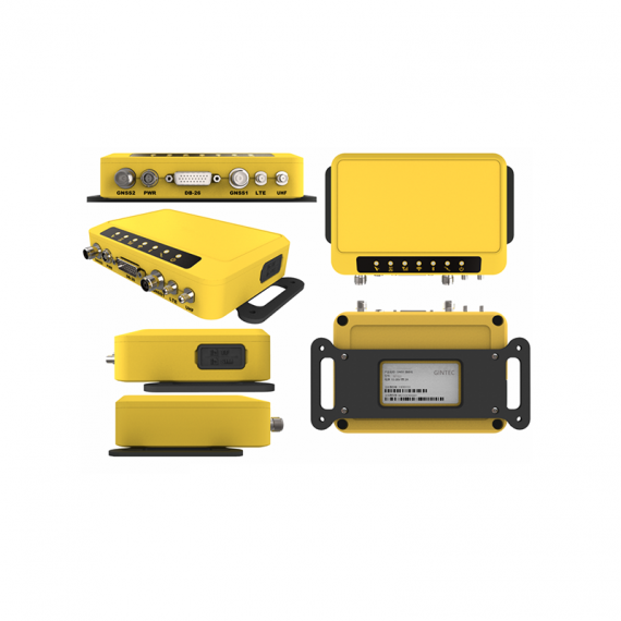


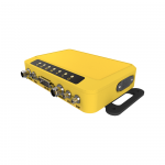


M1G2
The M1G2 high-precision GNSS Receiver is characterized by small size, complete functions, and multiple interfaces, which can be used as high-precision GNSS receiver for engineering and monitoring purposes
-
catalog
- M1G2.pdf (8.3M)
FEATURES
●Support remote configuration of M1G2
It can bind any changing IP address to a fixed secondary domain name, use this fixed domain name to access or log in the M1G2 and configure it remotely
●Web UI management platform
The platform supports WIFI mode connection, Users can monitor the receiver status and configure it via the internal Web UI management platform.
● Support custom coordinate system output
M1G2 has a built-in coordinate conversion algorithm, which can output latitude and longitude coordinates or plane projection coordinates according to user needs. Secondary development is convenient and efficient
● Support multiple cable ports:
GNSS Antenna port/LTE/UHF/PWR
D-SUB 26 interfaces: RS232/485, 1PPS, USB, EVENT, CAN, 100M Ethernet, support multiple interfaces to synchronize with other devices.
● Support multiple data output modes
Support network, mobile network, Bluetooth, WIFI, serial port and other ways to output location data, data acquisition is simple and efficient
● Solid and reliable structural design
It is designed with aluminum alloy shell, which can resist 1.5m free drop and realize the dust and water proof grade of IP67.The internal structure is designed in a simple and modular way to ensure normal operation under severe vibration working conditions.
● Separate Monitor Server and Client software
The two software are separate, so they can be set up and installed separately; this can avoid error operations and different format files be exported by different software.
● 7x24 hours of continuously monitoring
Conduct 7×24 real-time difference processing on the original GPS data, and conduct deformation monitoring without interruption
● Support multiple stations
The software supports the setting of multiple base stations. The known base stations corresponding to the monitoring points can be flexibly set
●Support automatic alarm
It can send an alert via E-mail or a short message
● Multiple data formats for export
The displacement deformation data of the monitoring station can be exported in “CSV”, ”HTML” and “DAT” format.
SPECIFICATIONS

PACKAGING
