


G20M
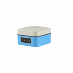
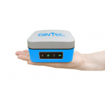
GINTEC G20M IMU RTK GNSS Receiver is equipped with 1408 channels UM980 OEM Boards. With only 580g magnesium alloy design, G20M is a powerful productive rover for surveyors in topographic and mapping, infrastructure, and construction. Small in size with superior performance.
-
catalog
- G20M.pdf (1.3M)
- Product Specifications
-
-
Full constellation tracking
-
-
UGypsophila RTK processing technology
-
-
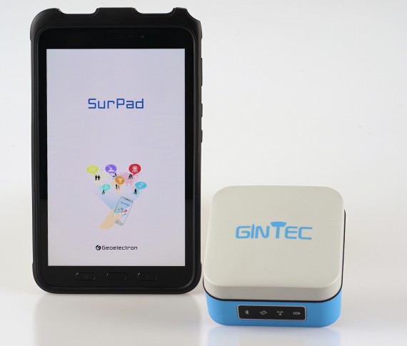
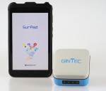
IMU tilt survey compatible with SurPad
-
-
Type-C fast-charge technology
-
-
9600mAh large capacity battery, one whole day work time
-
-
-
-
FEATURES
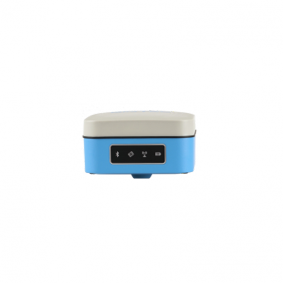
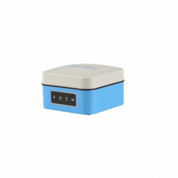
Small and Light Design
With only 580g magnesium alloy design, G20M is a powerful productive rover for surveyors in topographic and mapping, infrastructure, and construction.
Full Constellation Tracking
G20M can track the full constellation of GNSS satellites: GPS, Glonass, Galileo, and BeiDou. It maximizes the tracking to observe all visible and available GNSS satellite signals. With the aid of UGypsophila RTK processing tech, G20M, uses and locks more satellites, thereby performing better for real-time reliable data accuracy.
Fast-Charge Tech
G20M provides a type-C interface and supports multiple fast charging protocols. Surveyors can charge G20M using a portable phone battery anytime and anywhere.
Long Life Battery
With a built-in large-capacity lithium battery, G20M can last all day. The smart power button design can indicate battery level even in shutdown status.
Smart WEB UI Control
To provide a friendlier experience for first-timers and experienced users, we provide users with 2 kinds of WEB UI: The smart version and the Professional version.
SPECIFICATIONS
Item | Specification | |
Hardware system | Qualcomm MDM9628 Cortex-A7 | |
OS | Linux | |
GNSS | Channels | 1408 |
GPS | L1C/A, L1C, L2P(Y), L2C, L5 | |
GLONASS | G1, G2, G3* | |
BEIDOU | B1I, B2I, B3I, B1C, B2a, B2b* | |
GALILEO | E1, E5a, E5b, E6* | |
QZSS | L1, L2C, L5, L6* | |
IRNSS | L5* | |
SBAS | L1 | |
Cold Start | <12s | |
Initialization Time | <5s | |
Initialization Reliability | >99.9% | |
Position Accuracy | Single(RMS) | Horizontal:1.5m; Vertical:2.5m |
DGPS(RMS) | Horizontal:0.4m; Vertical:0.8m | |
RTK(RMS) | Horizontal:±(10mm+1ppm) Vertical: ±(15mm+1ppm) | |
Time accuracy(RMS) | 20ns | |
Speed accuracy(RMS) | 0.03m/s | |
Tilt compensate accuracy (within 30°) | <2cm | |
System | Bluetooth | V2.1+EDR / V4.0 dual mode |
WIFI | 802.11 a/b/g/n/ac | |
Network | LTE FDD: B1/B3/B5/B8 LTE TDD: B38/B39/B40/B41 TD-SCDMA: B34/B39 CDMA: BC0 WCDMA: B1/B8 GSM: 900/1800MHz | |
Internal Storage | 32GB | |
Indicator | Power Indicator | Show power status |
Satellite Indicator | Blink when effective position | |
Bluetooth Indicator | Light when Bluetooth connected | |
Datalink Indicator | Blink when get differential signal | |
Battery/ Charge | Battery | 3.7V,9600mAh |
Work time | More than 9hours | |
Charge | Support MTK PE+ 1.1/2.09V/1.6A Support USB PD12V/1.25A Support 5V/2A | |
Environment | Work temperature | -20℃~+60℃ |
Storage temperature | -40℃~+85℃ | |
Shock | Withstand 1.5M pole drop | |
Protection | IP65 | |
Physical | Material | Magnesium alloy mainbody, ABS/PC top cover |
Dimension | 100mm*100mm*61.5mm | |
Weight | 550g | |
A Full Set G20M | G20M GNSS receiver | 1 SET |
5V/2AUSB power adapter | 1 PC | |
USB A To Type-C cable | 1 PC | |
Connector | 1 PC | |
PACKAGING
Standard Package: G20M*1,Charger*1,Type-C Cable*1,Adaptor*1
